

Mount Leinster [Stua Laighean]
Good walks are even better shared.
S8252 : Walkers on Mount Leinster - view towards Blackstairs Mountain
Colin Park Photo source
Overview
Mount Leinster (794.4 m) is the highest mountain in both Carlow and Wexford and in the Blackstairs range. A steep service-road walk from Nine Stones reaches the summit cairn and trig point beside the broadcasting compound. The standard road return is about 5 km; rougher circuits need more time and navigation. The ancient cairn is about 4 m south-southeast of the trig: view it without climbing or moving stones. Respect access signs and stay outside the transmitter compound.
Mount Leinster [Stua Laighean]
Overview
Mount Leinster rises to 794.4 m on the Carlow–Wexford border. It is the highest mountain in both counties and in the Blackstairs range. A broadcasting installation dominates the summit; the database summit feature is an ancient cairn about 4 m south-southeast of the trig point. View the cairn without climbing it, adding stones or disturbing it. Stay outside the fenced transmitter compound.
Routes
Nine Stones service-road return
Start and finish at the Nine Stones car park on the L3005, approximately S817546. Follow the steep surfaced road uphill to the accessible summit cairn/trig area, then retrace the same road all the way to the car park. GPS Routes describes this complete out-and-back as about 5 km. Public access is on foot; an open vehicle gate is not permission to drive up. Allow for authorised service traffic.
Nine Stones and Black Banks circuit
Mountaineering Ireland’s Autumn 2020 account climbs the same road, then returns down it to the rough track near S824534, crosses Black Banks northwards and descends beside the forest to the road near S831555. The final road section returns to Nine Stones. The account allows about five hours for the complete circuit. Loose stone, wet rock, bog and a steep descent make this a more demanding choice, and the narrow road carries traffic. Check current access and forestry restrictions; do not follow an old description through a closure.
Access and facilities
Use the Nine Stones car park without obstructing gates or passing places, and check the posted parking arrangements. Bring food, water, waterproofs, warm layers and appropriate footwear. Bunclody, Borris and Myshall provide services in the surrounding area; check opening times before setting out. Leave dogs at home and obey no-dogs signs: the restriction is documented in the 2020 walking account and a local campaign was launched at Nine Stones in May 2026.
Bus Éireann route 132 and TFI Local Link route 369 serve Bunclody. No direct scheduled service to Nine Stones was verified. Arrange onward and return transport rather than relying on an unspecified short walk from a bus stop.
Terrain, weather and safety
The normal return follows steep tarmac and an exposed upper mountain. Low cloud can remove the views and make off-road navigation difficult. Strong winds, cold, snow and ice can make even this short road walk serious. Rougher options add wet rock, loose ground and bog. Carry navigation equipment and turn back when conditions exceed your experience. Check council notices and forecasts: a January 2025 council notice closed the Nine Stones approach during snow and ice. That is a historical event, not a current closure report or proof of unrestricted access today.
Geology and heritage
The Blackstairs have a granite core, part of the Leinster Granite intruded around 400 million years ago. Older Ordovician rocks occur on the range’s eastern side. The NPWS site synopsis describes protected wet and dry heath; avoid damaging vegetation and keep to durable routes. Geological Survey Ireland’s Carlow report gives the regional geological context.
The ancient summit cairn is recorded in the NPWS conservation plan. No precise date or named occupant is established here. The Nine Stones alignment is a separate roadside monument; its shepherd story is folklore. Stua Laighean is interpreted as “Arch of Leinster” in the Mountaineering Ireland account. Carlow Tourism records the older Suidhe Laighen name.
Views and nearby summits
Clear conditions reveal the Blackstairs, Carlow and Wexford countryside and the Wicklow Mountains. Mount Leinster East Top (656.5 m, S844527) is a separate summit; reaching it adds to the road return. Blackstairs Mountain is 732.1 m and Slievebawn is 524.8 m in the same local database. The roadside Nine Stones viewpoint is not Mount Leinster’s summit.
Source review
Desk research checked 17 October 2026 against DoBIH v18.6 row 20038 and the sources above. The database revision of 31 December 2014 is a row revision, not the physical survey date. The survey method is Abney level/Trimble GeoXH 6000; no physical survey date was established. The NPWS plan itself is dated July 2006 despite the website catalogue’s 2005 label. Access and weather must be checked again before a walk. Separate mapped routes and photographs are outside this text review.
Explore routes near Mount Leinster [Stua Laighean]
Walks starting near this hill. Open a route to check its map, distance and full itinerary.
Route planning notes
These notes describe possible approaches. Check a route's map and access information when planning your walk.
Nine Stones service-road return
Start and finish at Nine Stones car park (approximately S817546). Walk up the steep surfaced service road to the accessible summit cairn/trig area beside the broadcasting compound, then return down the same road to the same car park. GPS Routes gives about 5 km for this complete out-and-back. Stay outside the compound and do not climb the cairn or trig. Public access is on foot; keep clear of authorised vehicles and follow current signs. Wind, cloud, snow and ice can make the exposed upper road serious.
Nine Stones and Black Banks circuit
A complete circuit described by Mountaineering Ireland in Autumn 2020: start at Nine Stones, climb the summit service road, then descend the road to the rough track near S824534. Continue north over Black Banks, descend beside the forest to the mountain road near S831555, and follow the road back to Nine Stones. The source allows about five hours for the full circuit. This is rougher than the road return, with loose stone, wet bedrock, boggy ground and a steep descent, followed by narrow-road traffic. Check current access, forestry work and signs; use the road return instead if conditions or navigation are unsuitable.
Make a day of it, together
Find someone to share the walk with, or organise a day out along a route you like.
Photo Gallery
View all Photo could not load
S8252 : Walkers on Mount Leinster - view towards Blackstairs Mountain
Colin Park
 Photo could not load
S8252 : Phantom Mast
kevin higgins
 Photo could not load
S8252 : Mt Leinster Summit
kevin higgins
 Photo could not load
S8252 : Commemorative Plaque
kevin higgins
 Photo could not load
S8252 : Summit mast, Mount Leinster
Colin Park
 Photo could not load
S8252 : Mt. Leinster from Lorum
Alex Passmore
 Photo could not load
S8252 : Mast & Supports
kevin higgins
 Photo could not load
S8252 : Mast and Track
kevin higgins
 Photo could not load
S8252 : Hags and Mast
kevin higgins

S8252 : Masts on Mt. Leinster summit
Alex Passmore
Hill facts and local notes
Classifications
Elevation
794m
2,606 ft
Prominence
726m
Coordinates
52.6182, -6.7803
S826525
OS Map
68
At the Summit
The local hill database identifies an ancient cairn about 4 m south-southeast of the trig point as the summit feature at 794.4 m. The cairn and trig are beside the broadcasting compound. Do not climb on either, add or remove stones, or enter the fenced installation. Nine Stones is a lower roadside viewpoint; Mount Leinster East Top is a separate summit.
Terrain & Geology
Mount Leinster belongs to the granite-cored Blackstairs Mountains. Geological Survey Ireland identifies the Blackstairs Granite as part of the Leinster Granite, intruded in Early Devonian times around 400 million years ago. Older Ordovician slates and sandstones remain on the eastern side of the range. The Old Red Sandstone description formerly given here does not describe the mountain's granite core.
Views & Scenery
In clear weather, the summit overlooks the Blackstairs ridge and the countryside of Carlow and Wexford, with the Wicklow Mountains to the north-east. Cloud can obscure the panorama completely. Enjoy views from accessible ground outside the broadcasting compound.
History & Heritage
Name Origin
Stua Laighean is rendered as “Arch of Leinster” in Mountaineering Ireland's account. Carlow Tourism also records the older name Suidhe Laighen, interpreted as the seat or meeting place of the men of Leinster.
Historical Significance
The summit has an ancient cairn recorded by NPWS as monument CW023-007. Its precise age and occupant are not established by the sources checked. The Nine Stones roadside alignment is a different monument; the story of shepherds lost in a storm is folklore. The modern broadcasting compound is another prominent feature of the summit. Leave all archaeological stonework undisturbed.
Getting There & Facilities
Parking
Use the Nine Stones car park on the L3005, approximately Irish Grid S817546, and check the posted parking arrangements. Keep gates, passing places and transmitter access clear; do not drive up the summit service road even if its vehicle gate is open. Check local signs and council road notices, especially in snow or ice. Leave dogs at home and respect no-dogs signage and livestock restrictions.
Public Transport
Bus Éireann 132 serves Bunclody from Dublin via Tullow; TFI Local Link 369 links Bunclody with Enniscorthy and Tullow. These are town services, not verified buses to Nine Stones. Arrange onward and return transport and check current operator timetables. A short walk from a bus stop to the summit-route start has not been established.
Nearby Facilities
Bring water, food and suitable mountain clothing. Bunclody, Borris and Myshall provide services in the surrounding area; check individual businesses and opening times before setting out.
Safety Information
Known Hazards
- Exposed upper slopes: low cloud, strong wind and cold can make conditions serious even on the surfaced road.
- Steep tarmac can be slippery in rain, frost or snow; authorised service vehicles may use the road.
- The Black Banks circuit includes steep loose stone, wet bedrock, slippery grass and boggy pools.
- The circuit's narrow mountain-road return has traffic and limited refuge; take particular care.
- Do not enter the broadcasting compound or climb the ancient cairn or trig point.
- Leave dogs at home; respect no-dogs signs, livestock and any temporary access restrictions.
Seasonal Hazards
Snow and ice can make the steep summit road and the L3005 approach hazardous; the council has closed the Nine Stones road during severe winter weather. Check current notices and forecasts before travel. Low cloud and strong wind can affect the upper mountain in any season; wet rock, bog and slippery grass make the Black Banks circuit more demanding. Historical January 2025 closures are not a current closure notice.
General Safety Tips
- Check weather conditions before setting out
- Carry appropriate clothing and equipment
- Let someone know your planned route
- Take a map, compass, and GPS device
- Carry emergency supplies: food, water, first aid kit, torch
Hills
Some common questions about the hills answered
Are there group walks up Mount Leinster [Stua Laighean]?
Many walkers use Walkmates to join or organise walks with others. You can check for group walks around Mount Leinster [Stua Laighean] through the maps
Are there other walkers around Mount Leinster [Stua Laighean]?
Activity varies by location and time, but Walkmates lets you see whether others have shared walks or shown interest in this area. Find other people through the walking friends search walking friends for Mount Leinster [Stua Laighean] search or of course create your own walk for Mount Leinster [Stua Laighean]
Can I organise a walk to Mount Leinster [Stua Laighean]?
Yes. If there aren’t any walks listed already, you can create a walk and make it available for others to join.
If you're signed up to Walkmates, you can create a walk to Mount Leinster [Stua Laighean].
How do I find a walk up this hill?
There are often multiple ways to walk this hill, depending on experience and route preference. Walkmates helps you explore walks and routes that others have shared.
Can I suggest a new route up Mount Leinster [Stua Laighean]?
Yes. You can suggest or create routes to share with others. Walkmates focuses on the social side of walking, so routes are used to help people organise walks and explore areas together, rather than as detailed navigation tools or route libraries.
Other uses really appreciate knowledgeable walkers sharing their routes. Share your favourite route to Mount Leinster [Stua Laighean] here
The is an error or something incorrect about this hill. How do I let you know?
We always strive to keep the information on Walkmates as accurate as possible. If you find an error, please let us know through the contact form and we'll aim to correct it as quickly as possible
Community Discussion
Comments
Location
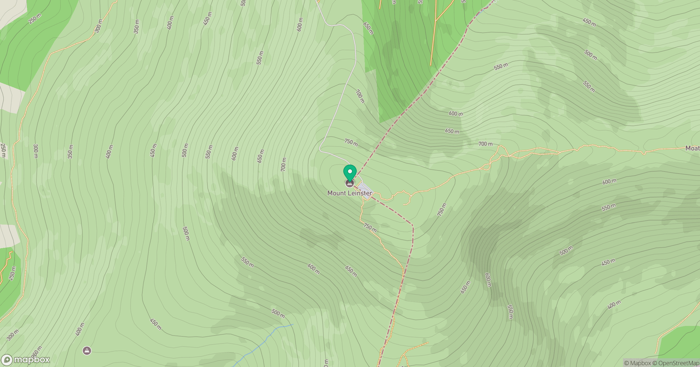
Grid reference: S826525
View on OpenStreetMapOpens a map in a new tab, centred on the hill.
No comments yet. Be the first.